I had the chance to get out to Johnstown, PA, on Sunday, to visit the scenes of the Johnstown Flood. Although I didn’t ride the train as I’d planned to, being in a vehicle meant my fellow historians and I could get up into the mountains to view what’s left of the South Fork Dam and the reservoir that was called Lake Conemaugh.
We then followed the path of the flood down through the valley into Johnstown, and visited some other historically significant spots. It’s always strange (but very much part of human nature) to find pleasure and interest in the scenes of a catastrophe. Having read about the flood at length it felt important to me to retrace it’s thundering steps though, and then I inevitably had to share that journey here with you!
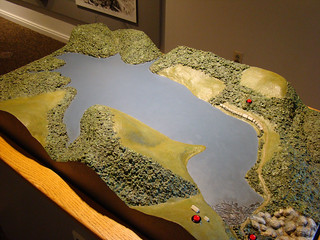
Starting at the beginning…here’s a diorama of the reservoir at the Johnstown Flood National Memorial museum – the dam is located in the bottom right corner of this picture.
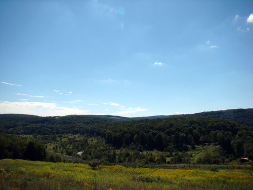
You can still kind of see where the lake lay – the remnants of the dam are on the right side of this picture. While the water is gone, the peacefulness remains. The wind makes waves in the goldenrod and a bit of creek sparkles in the bed of the former lake.

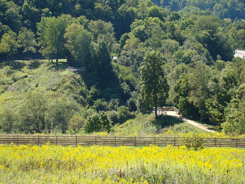
I’m enjoying a lovely summer day, like many folks who posed here on the dam before me, although they would have had the blue waters of Lake Conemaugh behind them.
The observation platforms you can see here (I was sitting on the near one in the picture above) are on either side of the gap…

…where the earthen dam burst apart on May 31st, 1889.
The rushing waters crashed down through 15 miles of twisting gorge before bursting into Johnstown.

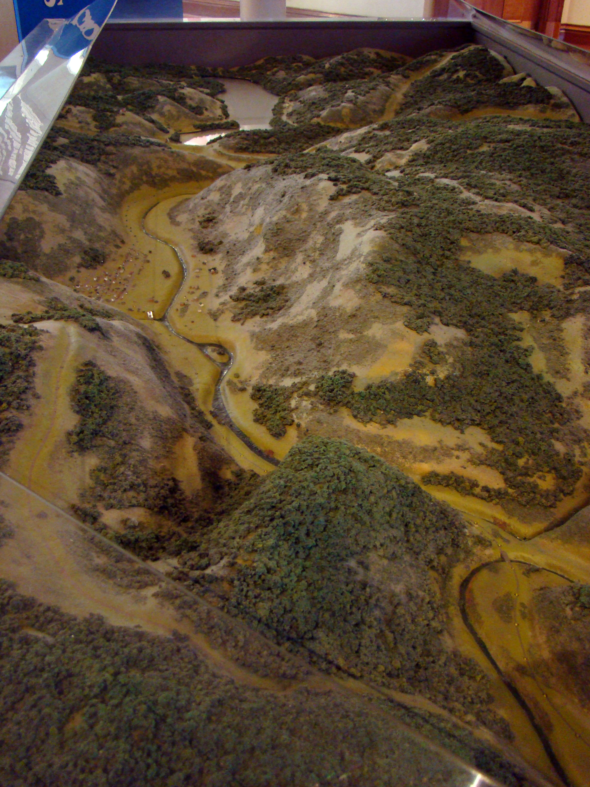
The water came from the left and crossed the center of Johnstown, slammed into the steep hillside on the right of the diorama (this one is located in the Johnstown Flood Museum in town), and turned to follow the valley out through the bottom of this image. The bulk of the flood was hindered by a stone bridge, which is the diagonal bar across the Stoneycreek River at the bottom right of the image above.
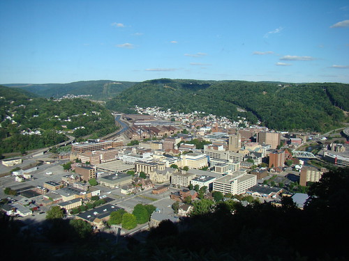
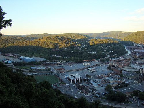
I took this picture from the top of that hill, so visualize the wave of water coming from the gap in the center of the image and crossing straight to the shadowy foreground. The waters were turned and then partially stopped, as I mentioned, by the stone bridge near the Cambria Iron Company.
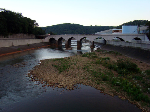
Debris blocked the arches and a huge fire broke out around the bridge, but it withstood everything and obviously still stands today.

The exhibits and photos at both the National Memorial site and the Johnstown Flood Museum were interesting to see, but I couldn’t get over the actual visuals – the real mountains and valleys that the flood poured down and through. Today…
And Johnstown before the flood…

After the 1889 flood, an incline was built to help folks get out of the flood plain faster in the event of another catastrophe. It starts at the bridge over Stoneycreek River, which you can see at the center bottom of the image above…
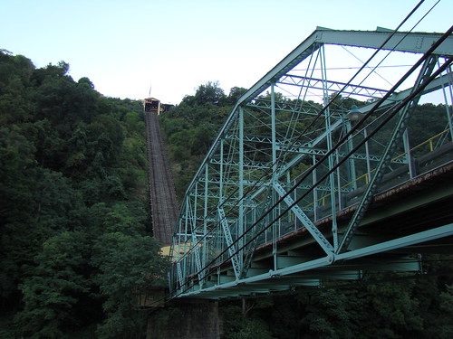
…and rises about 524 feet to the top of the hill at a 71% grade – the steepest in the world. After having dinner at a restaurant at the top, my boyfriend and I rode the incline back down the hill.
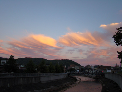
The sun set over Johnstown and the moon rose. On a Sunday night the town was quiet – but it’s often quiet these days. It has survived several more large floods, and the steel industry stuck around until the 90s. Now, though, the town is trying, like so many places in this area, to reinvent itself. It may be harder these days than ever before to rebuild, but Johnstown has had plenty of experience with making the best of things and getting on with life. I wish it luck!


Excellent blog. I love the fact that you followed the flood from the old dam to town. I too have a fascination, for whatever reason, with disasters, both natural and manmade. The Johnstown Flood has always peaked my interest, so much so that I researched it for over year, then wrote a fictional novella, SWEPT AWAY, about that Memorial Day weekend in 1889. It’s a young adult love story at its heart, but the threat of the dam looms over the whole tale. You can read more at my website http://paulwandrews.wordpress.com.
By: andrewspaulw on October 11, 2014
at 4:39 pm